 Jahangir's World Times First Comprehensive Magazine for students/teachers of competitive exams and general readers as well.
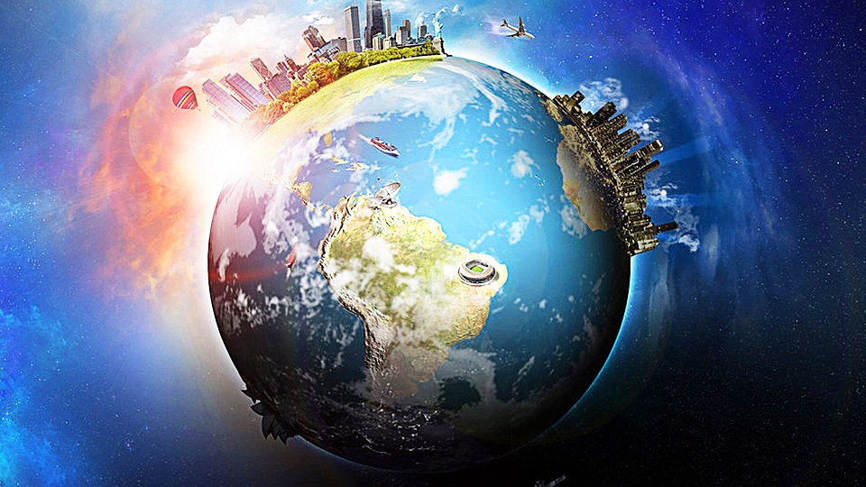
Physical Geography
Study of the Earth’s Features
Ghufran Wakeel
The discipline of geography has a history that stretches over many centuries. Over this time period, the study of geography has evolved and developed into an important form of human scholarship. Examining the historical evolution of geography as a discipline provides some important insights concerning its character and methodology. These insights are also helpful in gaining a better understanding of the nature of physical geography which is the study of our planet and all of its components: its lands, waters, atmosphere, and interior. It focuses upon the character of, and processes shaping, the land-surface of the Earth and its envelope, emphasizes the spatial variations that occur and the temporal changes necessary to understand the contemporary environments of the Earth. Its purpose is to understand how the Earth’s physical environment is the basis for, and is affected by, human activity.
The vast discipline of geography is divided into two major branches: 1) physical geography and 2) cultural or human geography. Physical geography encompasses the geographic tradition known as the Earth sciences tradition. Physical geographers look at the landscapes, surface processes, and climate of the earth—all of the activity found in the four spheres (the atmosphere, hydrosphere, biosphere, and lithosphere) of our planet. In contrast, cultural or human geography spends time studying why people locate where they do (including demographics) and how they adapt to and change the landscape in which they live. Someone studying cultural geography might also research how languages, religion, and other aspects of culture develop where people live; how those aspects are transmitted to others as people move; or how cultures change because of where they move.
Definition
Physical geography consists of many diverse elements. These include: the study of the earth’s interaction with the sun, seasons, the composition of the atmosphere, atmospheric pressure and wind, storms and climatic disturbances, climate zones, microclimates, the hydrologic cycle, soils, rivers and streams, flora and fauna, weathering, erosion, natural hazards, deserts, glaciers and ice sheets, coastal terrain, ecosystems, geologic systems, and so much more.
The Four Spheres
It’s a little deceiving (even overly simplistic) to say that physical geography studies the Earth as our home and looks at the four spheres because each possible area of research encompasses so much.
- Atmosphere
The atmosphere itself has several layers to study, but the atmosphere as a topic under the lens of physical geography also includes research areas such as the ozone layer, the greenhouse effect, wind, jet streams, and weather.
- Hydrosphere
The hydrosphere encompasses everything having to do with water, from the water cycle to acid rain, groundwater, runoff, currents, tides, and oceans.
- Biosphere
The biosphere concerns living things on the planet and why they live where they do, with topics from ecosystems and biomes to food webs and the carbon and nitrogen cycles.
- Lithosphere
The study of the lithosphere includes geological processes, such as the formation of rocks, plate tectonics, earthquakes, volcanoes, soil, glaciers, and erosion.
Sub-Branches of Physical Geography
Since the Earth and its systems are so complex, there are many sub-branches and even sub-sub-branches of physical geography as a research area, depending on how granularly the categories are divided. They also have overlap between them or with other disciplines, such as geology.
Geographical researchers will never be at a loss of something to study, as they often need to understand multiple areas to inform their own targeted research.
- Geomorphology
It is the study of Earth’s landforms and its surface’s processes—and how these processes change, and have changed Earth’s surface—such as erosion, landslides, volcanic activity, earthquakes, and floods
- Hydrology
It is the study of the water cycle, including water distribution across the planet in lakes, rivers, aquifers and groundwater; water quality; drought effects; and the probability of flooding in a region. Potamology is the study of rivers.
- Glaciology
It is the study of glaciers and ice sheets, including their formation, cycles, and effect on Earth’s climate
- Biogeography
It is the study of the distribution of life forms across the planet, relating to their environments; this field of study is related to ecology, but it also looks into the past distribution of life forms as well, as found in the fossil record.
- Meteorology
It is the study of Earth’s weather, such as fronts, precipitation, wind, storms, and the like, as well as forecasting short-term weather based on available data
- Climatology
It is the study of Earth’s atmosphere and climate, how it has changed over time, and how humans have affected it
- Pedology
It is the study of soil, including types, formation, and regional distribution over Earth
- Paleogeography
It is the study of historical geographies, such as the location of the continents over time, through looking at geological evidence, such as the fossil record
- Coastal geography
It is the study of the coasts, specifically concerning what happens where land and water meet
- Oceanography
It is the study of the world’s oceans and seas, including aspects such as floor depths, tides, coral reefs, underwater eruptions, and currents. Exploration and mapping is a part of oceanography, as is research into the effects of water pollution.
- Quaternary science
It is the study of the previous 2.6 million years on Earth, such as the most recent ice age and Holocene period, including what it can tell us about the change in Earth’s environment and climate
- Landscape ecology
It is the study of how ecosystems interact with and affect each other in an area, especially looking at the effects of the uneven distribution of landforms and species in these ecosystems (spatial heterogeneity)
- Geomatics
It is the field that gathers and analyzes geographic data, including the gravitational force of Earth, the motion of the poles and Earth’s crust, and ocean tides (geodesy). In geomatics, researchers use the Geographic Information System (GIS), which is a computerized system for working with map-based data.
- Environmental geography
It is the study of the interactions between people and their environment and the resulting effects, both on the environment and on the people; this field bridges physical geography and human geography.
- Astronomical geography or astronography
It is the study of how the sun and moon affect the Earth as well as our planet’s relationship to other celestial bodies
Why physical geography is important?
Knowing about the physical geography of Earth is important for every serious student studying the planet because the natural processes of Earth affect the distribution of resources (from carbon dioxide in the air to freshwater on the surface to minerals deep underground) and the conditions of the human settlement. Anyone studying processes involving Earth and its processes is working within the confines of its physical geography. These natural processes have resulted in a plethora of varied effects on human populations throughout the millennia.
Future Trends
The following list describes some of the important future trends in physical geography research:
- Continued development of applied physical geography for the analysis and correction of human-induced environmental problems. A student of applied physical geography uses theoretical information from the field of physical geography to manage and solve problems related to natural phenomena found in the real world.
- Remote Sensing: Advances in technology have caused the development of many new instruments for the monitoring of the Earth’s resources and environment from airborne and space platforms. The most familiar use of remote sensing technology is to monitor the Earth’s weather for forecasting.
- Geographic Information Systems: A geographic information system (GIS) merges information in a computer database with spatial coordinates on a digital map. Geographic information systems are becoming increasingly more important for the management of resources.
